Amazon Rainforest is often perceived as a hazy emerald blanket; but in sheer size, it is complex, a huge diverse continent that boasts of varied ecosystems and diverse climates and many countries. The Amazon which occupies an area of about 5.5 million Sq Km (2.1 million Sq miles) is the largest tropical rainforest on earth and an essential factor in terms of climate regulation, biodiversity and water cycles of the planet.
The geography of the discussion involves the area covered by the Amazon Rainforest by demarcating the countries that the Rainforest passes across, the physical aspects that characterize the Rainforest, the various ecosystems within the Forest as well as the links between the Rainforest and human civilization.
Geographic Location of the Amazon
Amazon Rainforest is located in South America, whilst the northern border of the forest can be generally defined by the line between the latitude 5 North and 15 South. Its eastern and western borders, respectively, are centralized by longitudes, say a range between 35 to 80 degrees West. This geographical location is strategic as the forest is right along the equator and this aspect gives it an equatorial status hence giving the forest a climate of constant rains and warm temperatures throughout the year. The location of the forest makes it have overall effects on the local climate and water cycle in not only South America, but the world as a whole.
Countries Covered by the Amazon Rainforest
The Amazon is a cross border eco-system that covers over nine countries in South America:
Country % of Amazon Covered Key Facts
Brazil ~60% Most; containing the mouth of the Amazon and the dense interiors forest
Peru ~13% Has impressive altitudinal forest as well as Andes to Amazon Life Zones
Colombia ~10% Amazon Eastern lowlands and indigenous territories
Venezuela ~6% It covers the OrinocoAmazon transitional zone
Ecuador ~2% High levels of biodiversity, great oil reserves, Yasuni National Park
Bolivia ~2% Southern most boundary of the forest; includes rivers and flood plain
Guyana less than 1% heavily wooded remote areas
Suriname 1% High forest cover and low density
French Guiana ~1% French possession; highly ecologically protective standards
Even though it is widely associated with Brazil, the Amazon is a continental biome extending to well over half of South America.
Terrain and Topography
The Amazon river basin does not have the same altitude. Among its borders, there is a great variety of different landforms:
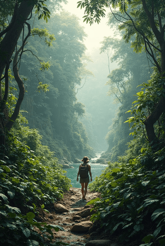
• Floodplains: Rocky plain areas that get submerged seasonally on the banks of rivers, and are highly nutritious;
Terra firme: The non floodable higher ground and the tall forests found there;
Vrzea: Whitewater-overflow woods;
Igapo: forests flooded by black water with acid soils;
Andean foothills: In Peru, Ecuador and Colombia, their source of rivers.
Such a topographic variety predetermines the distribution pattern of plant and animal species, which makes the Amazon extremely heterogenous.
Climate Zones Across the Amazon
The Amazon is of course often described as a homogeneously tropical system, but in fact, it too has subtle climatic patterns.
The region Climate Characteristics
Western Amazon More rain and Andean climate-influence, cool nights
Central Amazon Year round rain, tropical conditions all the time
located in Southern Amazon More seasonal variation, longer dry season
Eastern Amazon less rainy because of the influence of the Atlantic, some hunks of savanna
These varieties determine forest density, species distribution and pattern of agriculture.
Biodiversity Distribution Across Regions
Amazonian geography forms the basis of an incredible biodiversity. One cannot say that flora and fauna are evenly distributed; rather, there are particular areas that support unique species depending on soil type, altitude and water availability.
FIGURE 1. Map of Amazon. The map indicates the proposed hotspots in the region and major river basins in the area. [Source: Stumpf (2008)].
1. This park is the most biodiverse in the world per unit area, which is obtained through Yasun International Park (Ecuador).
2. Amphibians and endemics are found in particular abundance in the Western Amazon (PeruColombia).
3. Large mammals that can be found in central Brazil would include jaguars and tapirs.
4. Dolphins, manatees, piranhas and electric eels are included in river basins.
Each different part of the Amazon has its biological history.
Human Settlements and Cultural Zones
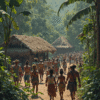
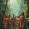
To the Amazon Basin belong over 30 million people and these people include:
• Native tribes (outnumbering 400 different groups), some of which are uncontacted
The Ribeirinhos communities are native people of Brazil and Peru
Manaus, Iquitos, and Leticia Urban centers
Mestizo communities that fit in between the European and the native cultures
Manaus (Brazil). Manaus, the capital of the state of Amazonas and one of the major ports of the Brazilian commerce, is now home of an important industrialization and trade point. Lots of the infrastructure of the city dates back to the development of rubber industry in the late nineteenth century, but the modern Manaus is deeply rooted in the native heritage.
Iquitos (Peru). Iquitos is the biggest city in the Amazon that has not been influenced by road access, although it can be symbolized by its riveritative economy and unique ethnic diversity. It is also a cultural capital of the city, the home of a famous festival and flourishing music.
Leticia (Colombia). Occupying a border area between three countries, including Peru and Brazil, Leticia is oriented on the production of transportation services and freshwater hydropower. The town has great trade center status and huge diplomatic and military influences.
Political and Conservation Boundaries
Boundaries between geographical areas are often political and conservation areas. Several nations have demarcated some of the Amazonian parts into national parks, indigenous reserves or preserves.
To Qualify As a Premier Conservation Area:
• Tumucumaque National Park (Brazil) is largest tropical forest park in the globe
Yasun National Park (Ecuador) is a biosphere reserve and the location of tensions about oil
• Pacaya-Samiria National Reserve (Peru) the flooded forests are crowded with wildlife
Despite such undertakings, deforestation and illicit mines as well as agriculture are still threatening even these concerned areas.
Conclusion
The Amazon Rainforest is simply much more than a single forest block; it is quite simply a multi-national system of rivers, cultures, species and ecosystems all transformed by its scale of geographical coverage. The geographical world wonder and which deserves all our attention and preservation is the region that extends itself horizontally across the Andean Highlands to the Atlantic coast, cuts across busy river cities and isolated tribals lands.
Being in a position to explain its layout comprehensively is not only essential in the study of science and its preservation but also in our ability to recognize that the Amazon is one entity that is highly diverse, ecological system, and a major support system to humanity and the earth. Mapping and conservation of the complete geographical area of the Amazon has become an imperative venture given the climate crisis times.