The Amazon rainforest, often referred to as the “lungs of the Earth,” is a vast and diverse ecosystem that spans across several countries in South America. This natural wonder is not just a marvel but also a critical component in the global environmental balance.
Its vast expanse is home to countless species of flora and fauna, many of which are found nowhere else on the planet. As we explore the Amazon rainforest’s geographical aspects, we will understand its significance and the need for its preservation.
Key Takeaways
- The Amazon rainforest covers a significant portion of South America.
- It is a critical component in the global environmental balance.
- The rainforest is home to a vast array of unique species.
- Preservation of the Amazon rainforest is crucial.
- The Amazon rainforest spans across several countries.
The Geographical Location of the Amazon: A Global Perspective
The Amazon, known for its lush tropical rainforest and vast river systems, is a critical component of the global ecosystem. It is primarily located in the Amazon basin, which is the largest drainage basin in the world, covering approximately 7 million square kilometers.
Defining the Amazon Region
The Amazon region is defined by its vast array of biodiversity, including numerous species of plants, animals, and insects. It spans across nine countries in South America, including Brazil, Peru, Colombia, Venezuela, Ecuador, Bolivia, Guyana, Suriname, and French Guiana. The region’s diverse ecosystems range from dense rainforests to vast river systems, making it one of the most ecologically significant areas on the planet.
Ecological Significance: The Amazon is often referred to as the “lungs of the Earth” due to its role in producing oxygen and regulating the global climate. As stated by the Amazon Conservation Association, “The Amazon rainforest is a vital component of the global ecosystem, providing numerous benefits to both local and global communities.”
“The Amazon is a region of immense ecological importance, supporting a vast array of plant and animal life.”
Geographical Coordinates and Boundaries
Geographically, the Amazon basin is bounded by the Andes Mountains to the west, the Atlantic Ocean to the east, the Gran Sabana region to the north, and the Brazilian Plateau to the south. The geographical coordinates of the Amazon rainforest generally fall within 5° N to 15° S latitude and 75° W to 50° W longitude.
| Geographical Feature | Location |
|---|---|
| Andes Mountains | Western boundary |
| Atlantic Ocean | Eastern boundary |
| Gran Sabana region | Northern boundary |
| Brazilian Plateau | Southern boundary |

The Amazon Across National Boundaries
The Amazon is not confined to a single country; it is distributed across various nations in South America. This vast rainforest is a multinational ecosystem that requires cooperation among the countries it inhabits.
Brazil: Home to the Largest Portion
Brazil hosts the largest portion of the Amazon rainforest, with approximately 60% of the rainforest lying within its borders. The Brazilian Amazon is not only vast but also rich in biodiversity, hosting a significant portion of the world’s species.
The Brazilian Amazon is crucial for global climate regulation and is home to numerous indigenous communities. Efforts to preserve this region are vital for both Brazil and the world.
Peru and Colombia: Major Amazon Countries
Peru and Colombia are other significant countries with substantial parts of the Amazon rainforest. Peru’s Amazonian region is known for its rich biodiversity and indigenous communities. Colombia’s Amazon region is characterized by its unique cloud forests and river systems, contributing to the Amazon’s ecological diversity.
Other South American Nations with Amazon Territory
Other countries that share the Amazon territory include Venezuela, Ecuador, Bolivia, Guyana, Suriname, and French Guiana. Each of these countries contributes to the rich tapestry of the Amazon ecosystem. Together, they face the challenges of preserving this vital resource.

The Amazon rainforest’s multinational presence underscores the need for international cooperation in conservation efforts. By working together, these countries can better protect the Amazon and its inhabitants.
The Amazon Basin: Geographical Features and Topography
The Amazon Basin is a vast and complex geographical entity that has been shaped by millions of years of geological history. This region, encompassing a significant portion of South America, is characterized by its diverse topography and rich geological past.

Formation and Geological History
The formation of the Amazon Basin is a story that spans millions of years, beginning with the erosion caused by the Amazon River and its numerous tributaries. This process has carved out a vast landscape, creating a basin that is not only geographically significant but also ecologically vital. The geological history of the basin is marked by the uplift of the Andes Mountains, which played a crucial role in shaping the region’s topography.
Topographical Characteristics of the Basin
The topography of the Amazon Basin is varied, ranging from the foothills of the Andes in the west to the vast floodplains and lowlands in the central and eastern regions. The basin is characterized by its dense rainforest, sprawling river systems, and seasonally flooded forests known as várzea. These diverse topographical features support a wide range of ecosystems, making the Amazon Basin one of the most biodiverse regions on the planet.
The basin’s topography is also influenced by its hydrological features, including the Amazon River, which is the lifeblood of the region. The river and its tributaries have created a complex network of waterways that support the rich biodiversity of the basin.
The Amazon Biome’s Natural Boundaries
The natural boundaries of the Amazon biome are defined by its unique ecological characteristics, including the types of vegetation, soil composition, and hydrological features. The Amazon Basin’s boundaries are not strictly geographical but are also determined by the ecological continuity of the region. Understanding these boundaries is essential for managing the basin’s natural resources sustainably and conserving its biodiversity.
In conclusion, the Amazon Basin’s geographical features and topography are a testament to its complex geological history and ecological significance. The region’s diverse landscapes, from the Andes foothills to the vast floodplains, support a rich array of ecosystems that are vital for the health of our planet.
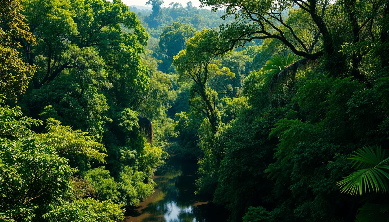
Mapping the Amazon River: The Lifeblood of the Rainforest
Stretching over 6,400 kilometers, the Amazon River is not only a geographical marvel but also an ecological lifeline. The Amazon River is a vital component of the Amazon rainforest, supporting a vast array of ecosystems and biodiversity.
Amazon River Location and Course
The Amazon River originates in the Andes Mountains in Peru and flows east through Brazil to its mouth in the Atlantic Ocean. Along its course, it passes through a variety of landscapes, from the highlands of Peru to the vast plains of Brazil. The river’s length and discharge volume make it one of the most significant rivers globally.
The Amazon River’s journey is remarkable, with its waters traveling through diverse geographical regions. This journey is crucial for the ecosystems it supports, including flooded forests and riverine communities.
Major Tributaries and Their Geographical Significance
The Amazon River is joined by numerous major tributaries, including the Ucayali, Marañón, and Rio Negro. These tributaries contribute significantly to the Amazon River’s discharge and geographical significance. They help in shaping the landscape and supporting the rich biodiversity of the region.
| Tributary | Length (km) | Average Discharge (m³/s) |
|---|---|---|
| Ucayali | 1,600 | 13,000 |
| Marañón | 1,737 | 16,600 |
| Rio Negro | 2,250 | 28,400 |
Visualizing the Amazon River Basin
Maps and satellite imagery play a crucial role in understanding the Amazon River basin. They help in visualizing its vast extent and the interconnectedness of its waterways. The Amazon River basin can be seen as a complex network of rivers, streams, and wetlands that support a rich variety of life.

By examining the Amazon River and its basin through various geographical and ecological lenses, we can better appreciate its significance. The river is not just a geographical feature; it’s the lifeblood that sustains the Amazon rainforest and its inhabitants.
Climate and Geography: The Amazon’s Unique Ecosystem
The Amazon rainforest is renowned for its complex ecosystem, which is intricately linked to its climate and geographical features. This ecosystem supports an immense array of plant and animal life, making the Amazon one of the most biodiverse regions on Earth.
The Amazon’s ecosystem is characterized by several distinct habitats, each with its unique characteristics. One of the most notable is the várzea, or seasonally flooded forests.
Várzea: Seasonally Flooded Forests
Várzea forests are periodically inundated by the Amazon River and its tributaries, creating a dynamic environment that is rich in nutrients. This flooding brings nutrient-rich sediments that support a diverse range of flora and fauna adapted to these conditions. The várzea ecosystem is crucial for many species, providing breeding grounds and food sources.
Terra Firme: The Upland Forests
In contrast to the várzea, the terra firme, or upland forests, are not subject to regular flooding. These forests are characterized by their dense canopy and diverse plant species. Terra firme forests cover a significant portion of the Amazon basin and are home to a vast array of wildlife, including many iconic Amazonian species.

Geographical Distribution of Biodiversity
The geographical distribution of biodiversity in the Amazon is remarkable, with different habitats supporting a wide range of plant and animal species. The varied landscapes within the Amazon, from flooded forests to upland areas, create a mosaic of ecosystems that together support an incredible array of biodiversity. This diversity is a result of the complex interplay between the Amazon’s climate, geography, and biological processes.
The Amazon rainforest’s unique ecosystem is a result of its intricate geography and climate. Understanding and preserving this ecosystem is crucial for maintaining global biodiversity and ecological balance.
Conclusion: The Amazon’s Geographical Significance in a Changing World
The Amazon rainforest is a vast and diverse ecosystem that spans across multiple countries in South America, playing a critical role in the global environment. Understanding the geographical location of the Amazon is essential to appreciating its significance.
The Amazon basin, which encompasses the Amazon jungle location, is a complex network of rivers, forests, and wetlands that support an incredible array of biodiversity. As the world grapples with the challenges of climate change, preserving the Amazon rainforest is more crucial than ever.
Efforts to conserve and sustainably manage the Amazon rainforest are vital for maintaining its ecological integrity and ensuring the well-being of the planet. By recognizing where the Amazon rainforest is located and its geographical significance, we can work towards a more sustainable future.


